Do you have a project we can help with?
Services
Through the use of 3D Geographic Information System, specialized software specifically made by the company and specific operating procedures (as high output cartographic selective restitution), Gis Design is able to satisfy numerous necessities in the field of airport safety, according to ICAO, EASA, national standards.
.
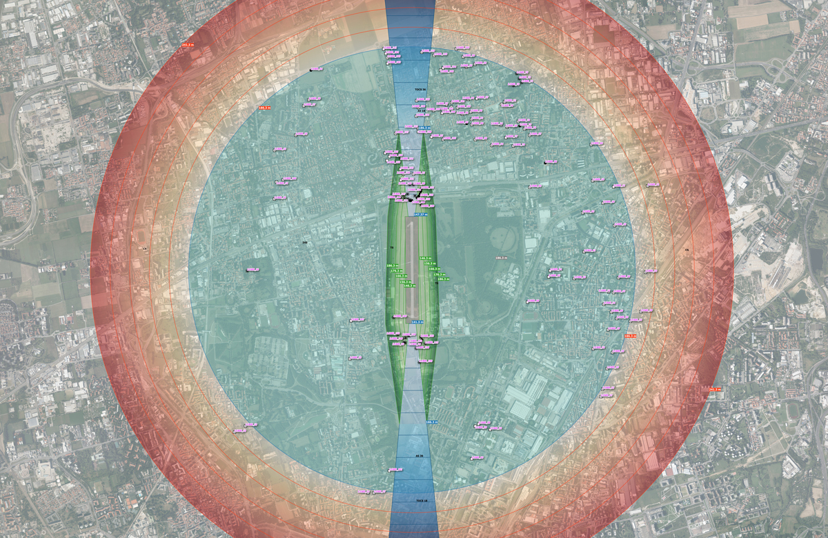
Obstacle Delimitation Surface
Generation of Obstacle Delimitation and Identification Surfaces (compliant with EASA CS-ADR-DSN).
Census of air navigation obstacles
Census of air navigation obstacles within the areas under jurisdiction of the airport manager (compliant with EASA Decision AMC & GM for Aerodromes) and realisation of obstacles monographs.
eTOD implementation
Implementation of the Electronic Terrain and Obstacles Data eTOD through the 3D Geographic Information System structuring for the air navigation obstacles representation and management.
Monitoring obstacles
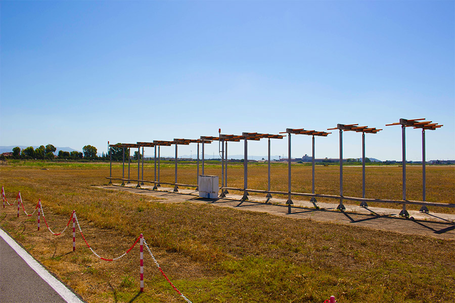
Monitoring obstacles marking and lighting system (Reg. UE 139/2014 Surroundings), even in real-time with fault detection automatic systems.
Aerodrome Chart Elaboration
Aerodrome chart type “A” and “B”, constraint and obstacles delimitation maps elaboration.
Surveys
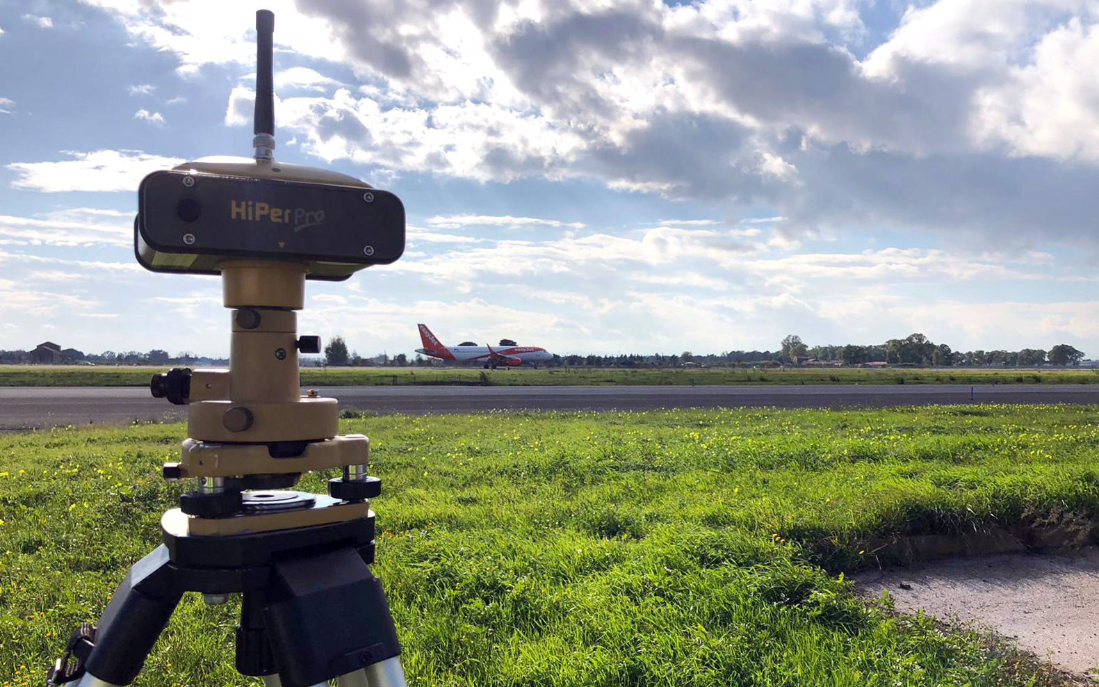
Potential air navigation obstacles identification with high-precision GPS surveys, satellite images, aerial photogrammetric survey and numerical cartography, LiDAR mapping campaign and DTM and DSM digital model creation.
Monitoring Surrounding
Monitoring areas around the aerodrome (Surrounding), under Regulation (UE) n. 139/2014 (EASA ADR.OPS.B.075): obstacles and the possibility of induced turbulence; the dazzling caused by reflective surfaces; sources of non-visible radiation, etc.
Monitoring Wildlife
Monitoring Wildlife strike hazard (EASA ADR. OPS.B.020)through the use of satellite images and GIS implementation.
THE NUMBERS THAT COUNT

Gis Design has created and developed the ALBATROS application, specifically designed for managing existing air navigation obstacles and analyzing local data of airport interest. ALBATROS is an expansion of the GIS (Geographic Information System) software, also working in Open-Source, that allows the management of existing obstacles, in addition to the possibility to identify new ones by means of three-dimensional analysis made by the software itself. This allows the airport manager to spare time and costs of service supply.
Clients
Gis Design has conducted over 30 projects, commissioned by both private and public clients of all sizes.